Common Duckweed
Lemna minor
Common Duckweed is a free-floating species that forms dense mats across the water surface of semi-permanent marshes.
Section 2.3
Summary of the area of wetlands in the prairie region by wetland class with a description of the most common classes.


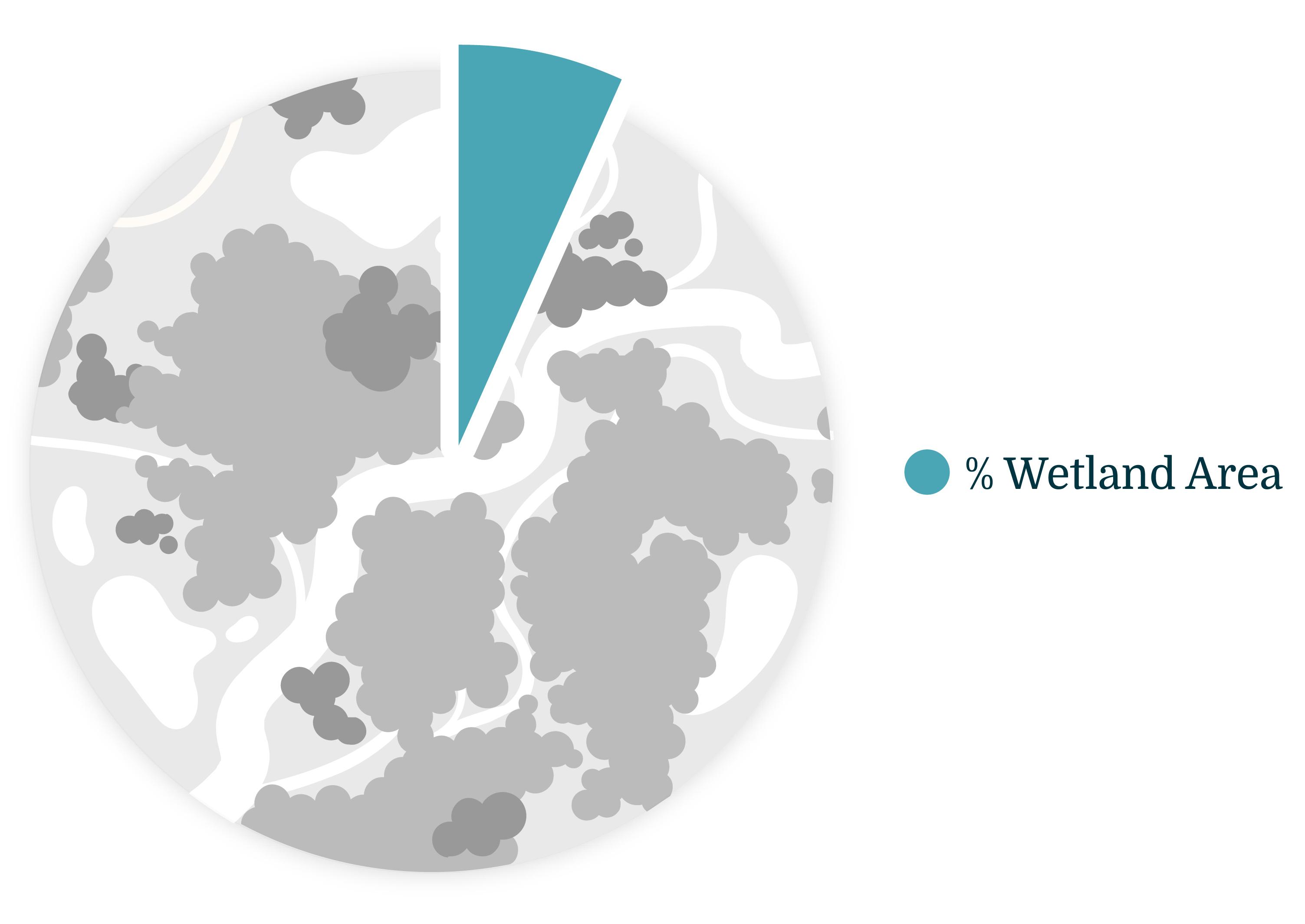
Total area of wetlands in the prairie region: 6.9%
While wetlands cover a small area of the prairie region, they serve a number of important functions:
Wetlands in the prairie region have been impacted by human development activities:
In this section, we summarize wetland class and percent area covering the prairie region in Alberta. We also highlight key wetland characteristics and species associated with the most common wetland classes.
 Amelia Martin
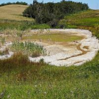
Hydroperiod was calculated to differentiate open water areas from seasonally flooded potholes.
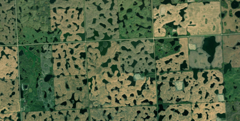
Area of Wetlands in the Prairie Region
Total area of wetlands in the prairie region: 6.9%
Distribution of wetlands in the prairie region of Alberta. Click on the legend to turn wetland types on and off. Note: wetlands cover less area than what is displayed in the map.
Click on a tab for a description of the most common wetlands in the prairie region. For more detailed descriptions of each wetland class, refer to the Alberta Wetland Classification System Field Guide[3].
 Andreas Rockstein
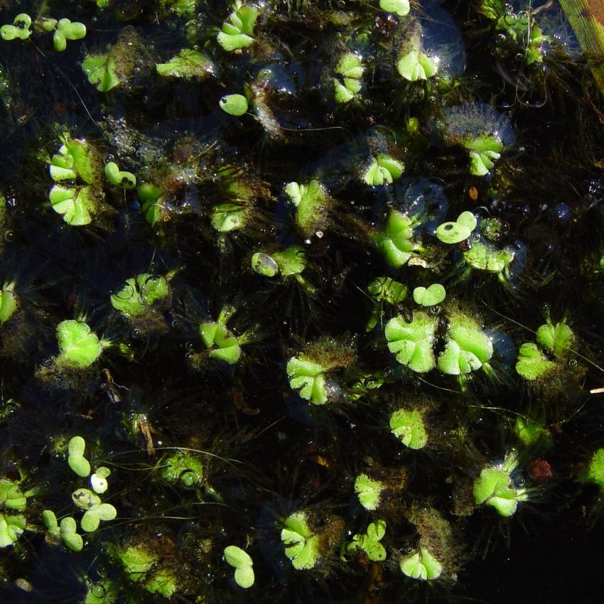
Lemna minor
Common Duckweed is a free-floating species that forms dense mats across the water surface of semi-permanent marshes.
 Andrew DuBois
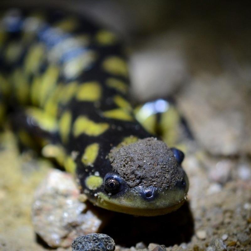
Ambystoma mavortium
The Tiger Salamander is widely distributed in the prairie region of Alberta. It breeds in permanent or semi-permanent lakes, ponds or wetlands that are free of fish.
 Rob Hinchliffe
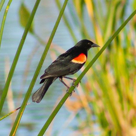
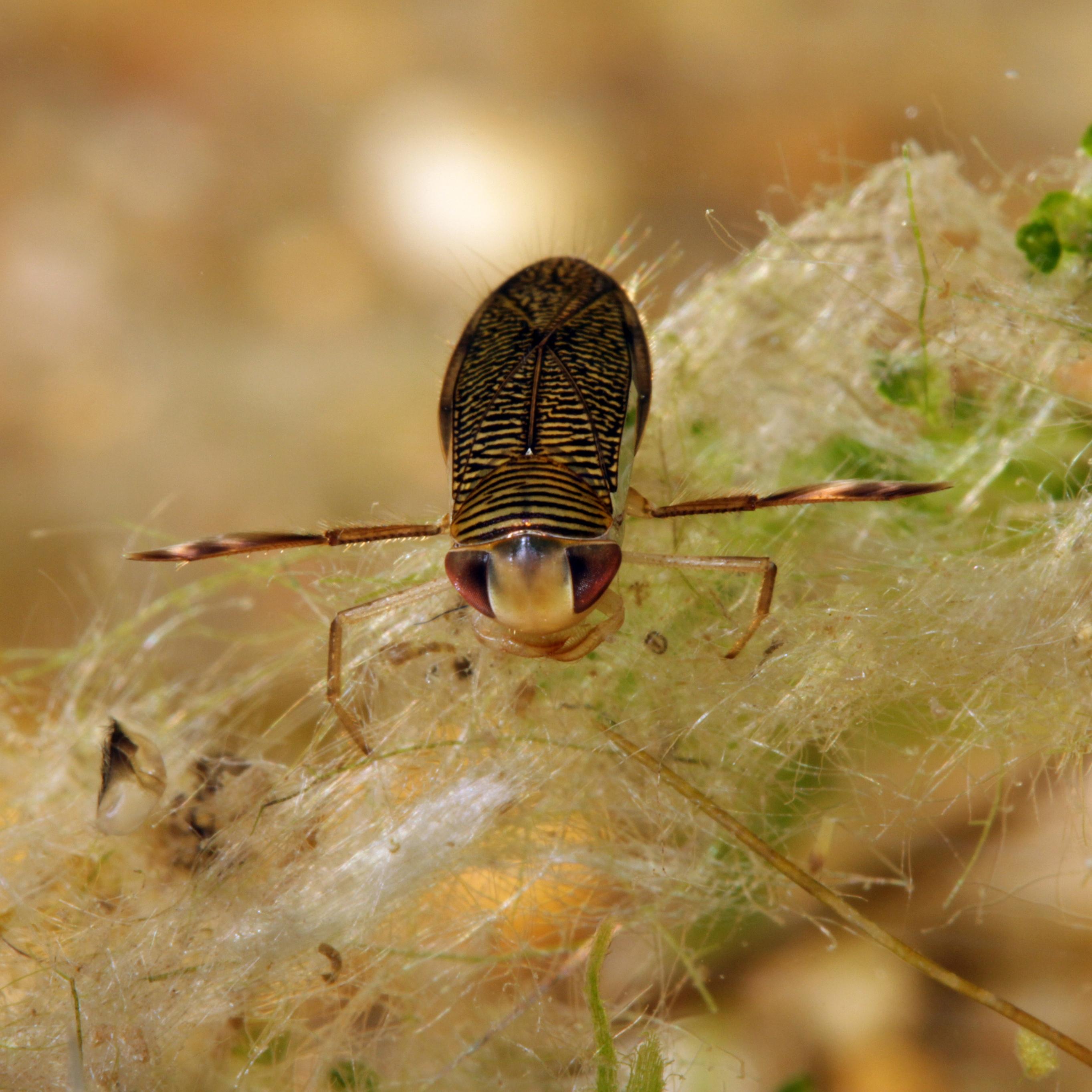
Corixidae
This large family of true bugs, commonly called water boatmen, can be found in even the smallest of temporary prairie ponds.
 Rob Hinchliffe
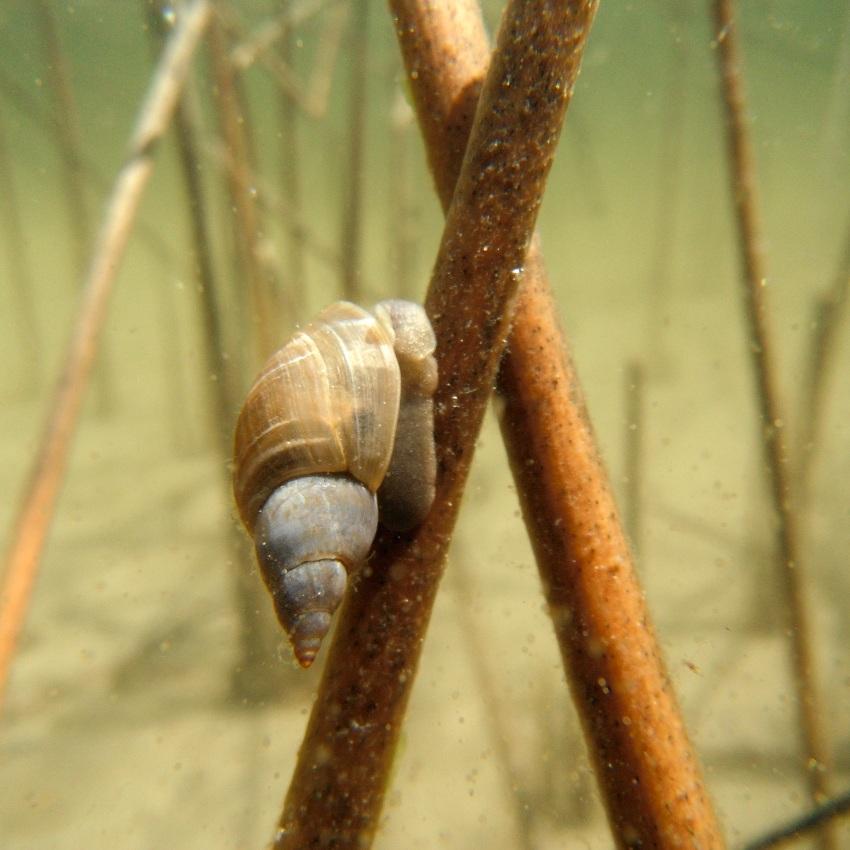
Stagnicola elodes
The Marsh Pond Snail is one of the more common and larger snails found in marshes and ponds in the prairie region. They live anywhere from one to three years and can lay several batches of eggs throughout the summer months.
 Rob Hinchliffe
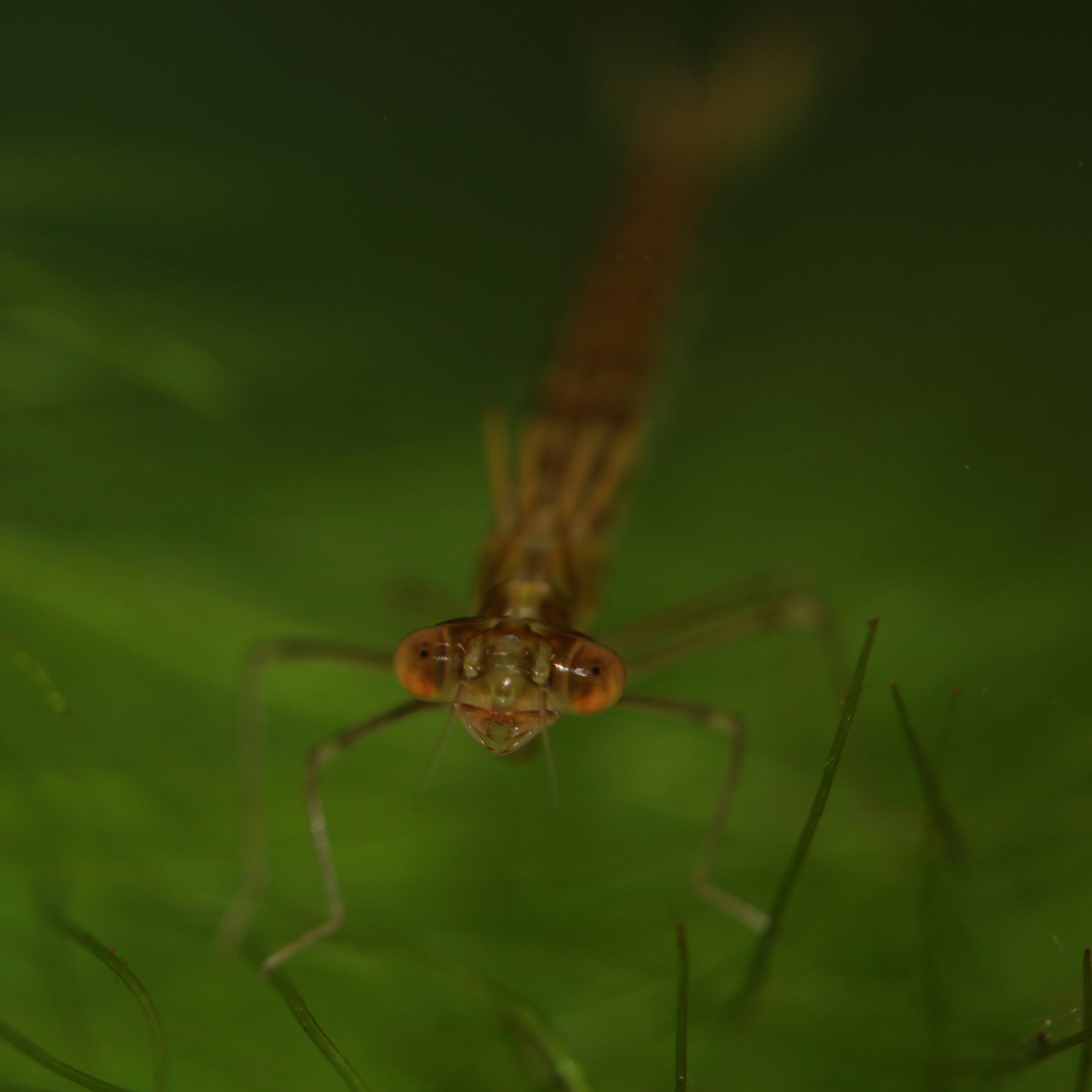
Lestes spp.
Spread-wing damselfly adults chase down small flying bugs around prairie wetlands and in the surrounding terrestrial habitats.
 Wolfram Sondermann
Ricciocarpos natans
This aquatic liverwort can be found growing in dense floating colonies or stranded on muddy spots when the water level drops. It is easily confused with common duckweed from a distance.
Dahl, T.E. and M.D. Watmough. 2007. Current approaches to wetland status and trends monitoring in prairie Canada and the continental United States of America. Canadian Journal of Remote Sensing 33:sup1, S17-S27. Available at: https://doi.org/10.5589/m07-050
ABMI Geospatial Centre. 2021. ABMI Wetland Inventory: technical documentation. Report available at: https://abmi.ca/home/data-analytics/da-top/da-product-overview/Advanced-Landcover-Prediction-and-Habitat-Assessment--ALPHA--Products/ABMI-Wetland-Inventory.html
Ducks Unlimited Canada. 2021. Alberta wetland classification system field guide. Available at: https://www.ducks.ca/resources/industry/alberta-wetland-classification-guide/

Jennifer Hird, Lead Scientist—Earth Observation Insights Unit, Alberta Biodiversity Monitoring Institute (ABMI)
Jen has supported geospatial research and development within the ABMI for over 10 years. In her current role, she leads the organization's satellite-based mapping and monitoring efforts.
If you have questions about the ABMI's wetland mapping program, please get in touch: jennifer.hird@ualberta.ca