Section 2.5
Regional Patterns in the Water Balance of Alberta's Wetlands
Isotope analysis was used to study the flow of water through open water wetlands across Alberta

 Stephanie Ball
- Regional patterns of water flow through wetlands were investigated across Alberta.
- Concentrations of naturally occurring isotopes of oxygen and hydrogen were measured in open water wetlands. These data, combined with information on climate and watershed area, were modelled to quantify and map water balance indicators, including precipitation, surface flow into and out of wetlands, groundwater inflow and outflow, and evaporation.
- Patterns of water flow into and out of wetlands were revealed across the natural regions of Alberta. Highlights show that 47% of wetlands likely have groundwater inflow, and that 2% of wetlands (located mainly in the mountains) appear to receive surface flow from snow and glacial melt outside the delineated watershed areas. In terms of outflow, 13% of wetlands (located mainly in the prairies) lose water mainly through evaporation, and 87% have surface and/or groundwater outflow.
- The results of this study provide baseline information about the basic hydrology of wetlands in Alberta, which can be compared with future measurements.
- Full study results are available in Gibson et al. 2022[1].
Background
- Wetland water balance is used to quantify the sources of water entering and leaving wetlands through measurements of the main components of the water cycle, including direct precipitation, surface flow into and out of the wetland, groundwater inflow and outflow, and evaporation.
- The flow of water through wetlands is affected by natural factors such as climate, underlying geology, landscape position, vegetation, as well as by human disturbances within and around the wetland.
- Understanding a wetland’s water balance is important to ensure an adequate and persistent supply of water, and to minimize the effects of development activities on a wetland’s natural functions, including flood mitigation and water storage, maintenance of water quality, and habitat supply for wildlife and plants.
- The purpose of this study was to examine regional patterns in the water balance of open water wetlands across Alberta using isotopes. Concentrations of naturally occurring isotopes of oxygen and hydrogen molecules were used to trace the movement of water in wetlands.
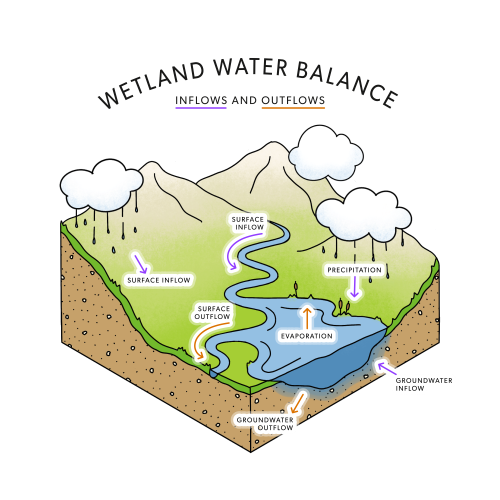
Components of the water cycle that are measured to quantify the water balance of open water wetland ecosystems (modified from Gibson et al. 2022).
More about isotopes
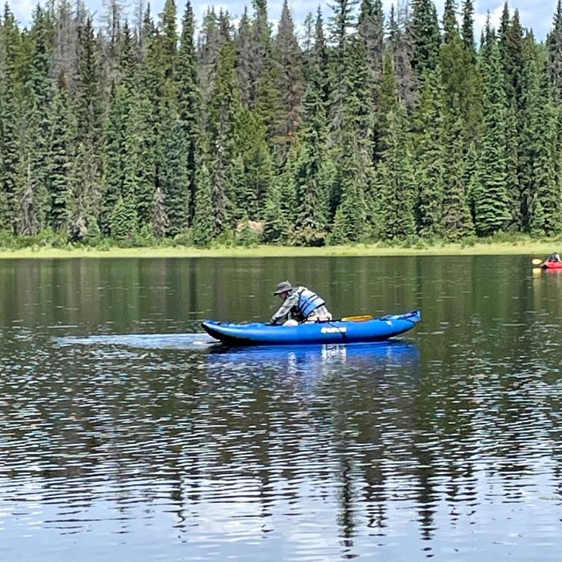
Water samples are collected from open water wetlands...

...and transported to the lab...

...where isotope concentrations are measured.
- Isotopes are varieties of a specific atom, such as hydrogen or oxygen, that have the same number of electrons and protons but a different number of neutrons. Isotopes therefore have different atomic masses, which can be used to trace water origin, movement, and residence time.
- Water molecules (H2O) are composed of two hydrogen atoms and one oxygen atom. A widely used technique for quantifying the hydrology of wetlands involves measuring the concentrations of naturally occurring isotopes of oxygen and hydrogen contained within water molecules.
- The isotopes examined in this study were oxygen-18 (18O), which has two more neutrons than “normal” oxygen, and deuterium (2H), which has one more neutron than “normal” hydrogen.
- Concentrations of these isotopes vary in response to natural processes. For example, when water evaporates from a wetland, more of the heavier isotopes (oxygen-18 and deuterium) are left behind, increasing their relative concentrations in the wetland and providing information about whether the outflow is dominated by evaporation compared to water outflow (surface and/or groundwater).
- In wetlands, heavy isotope signatures in surface water as well as isotope mass balance models can be used to determine the main source of water, either surface water or groundwater, for open water wetlands.
About This Study
This study was part of a joint program between the Alberta Biodiversity Monitoring Institute (ABMI) and InnoTech Alberta, investigating water balance processes and the relationships between hydrology, vegetation, and ecosystems within Alberta.
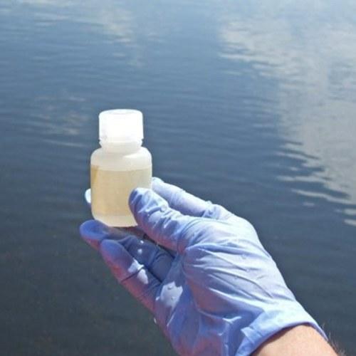
- Water samples were collected at 1,022 open water wetlands between 2009 and 2019 (note: water sampling is ongoing).
- These water samples were processed in InnoTech Alberta’s lab, and the relative concentrations of 18O and 2H were measured.
- An isotope mass balance model was applied to determine the main sources of water inputs and outputs in open water wetlands across the province, including: direct precipitation, surface flow into and out of the wetland, groundwater inflow and outflow, and evaporation.
- For detailed methods, see Gibson et al. 2022.

Water samples being processed in the lab at InnoTech Alberta.
Highlights
- Water yield is positive for 90% of the open water wetlands in Alberta, meaning that the landscape contributes water to these wetlands but this is balanced by outflows. Water supply to these wetlands is likely sustainable.
- Of the 10% of wetlands with water deficits, many occur in the Grassland Natural Region, where water loss via evaporation tends to be higher than water inputs due to precipitation. Wetlands with water deficits generally have weaker hydrological connections with other wetlands or river systems, are prone to water loss, and may be unsustainable in the long term.
- Groundwater inflow is an important water input for 47% of wetlands in Alberta. Groundwater-reliant wetlands can be found in all natural regions, but groundwater is essential for maintaining many wetlands in the Grassland Natural Region.
- Snow and glacial melt upstream of wetlands' catchment areas (allochthonous water sources) appear to contribute to the inflow of water for 2% of wetlands, found mostly within the Rocky Mountain and Foothills natural regions; these wetlands appear to be highly connected to regional river systems.
- In areas with oil sands deposits, initial assessment suggests that between 20% and 40% of wetlands rely on groundwater inflow, which is slightly lower than the surrounding region, estimated at 35%–50%.
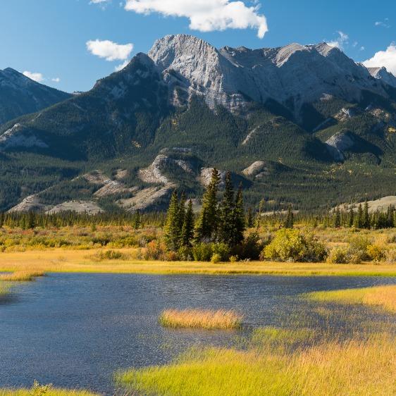
Some mountain wetlands appear to receive inflow from glacial and snow melt outside their catchments.
- For 87% of open water wetlands in Alberta, water loss is due to a combination of evaporation and surface and/or groundwater outflow.
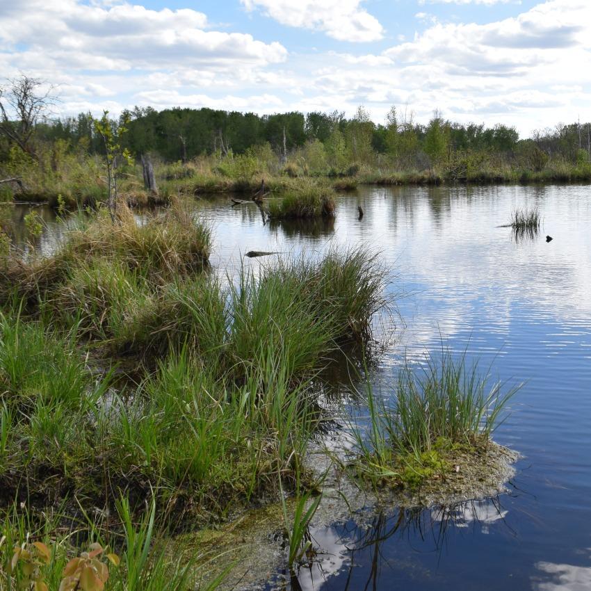
- Evaporation is the main mechanism of water loss for 13% of assessed wetlands; these wetlands are scattered across the province, occurring as individual sites or as local clusters.
- Evaporative wetlands appear to be more common in the western part of the Grassland Natural Region and in the transition area between the Parkland and Boreal Forest natural regions.
- Some remote or difficult-to-access areas of the province have yet to be characterized and sampled.
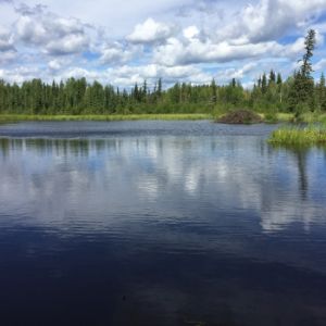
Evaporation is the main mechanism of water loss in many prairie wetlands.
Conclusions and Next Steps
- The results of this study provide baseline information about basic water flow through open water wetlands in Alberta, allowing researchers to make comparisons between geographic areas under current conditions. Future resampling will enable comparisons between different points in time.
- Measurements established in this study can be used to predict geographic settings and specific locations where impacts from development are more likely to arise, thus supporting the prioritization of monitoring efforts.
- The current version of the model provides an initial assessment of water flow in open water wetlands in Alberta. Further refinements to the basic framework and model parameters are ongoing and show great potential for improvement.
- The ABMI will continue to work with InnoTech Alberta to further enhance this highly valuable dataset, and to use the model to investigate how the sources and drivers of evaporation and the inflow and outflow of water affect the biodiversity associated with wetlands in Alberta.
References
Gibson J.J., P. Eby, C. Twitchell, C. Gray, and J. Kariyeva. 2022. Isotope-based water balance assessment of open water wetlands across Alberta: regional trends with emphasis on the oil sands region. Journal of Hydrology: Regional Studies 40:101036. https://doi.org/10.1016/j.ejrh.2022.101036
Contributors

Dr. John Gibson, Principal Researcher, Environmental Services, InnoTech Alberta
Dr. Gibson is the Principal Researcher, Environmental Services Division, at InnoTech Alberta, and is a research professor affiliated with the University of Victoria. He is a specialist in isotope tracer techniques with 30+ years of experience in regional, national, and international water projects. Dr. Gibson oversees the water resources program at InnoTech Alberta, and has led or is co‐investigator in a wide variety of industry‐ and government‐funded environmental studies including: geochemical and isotopic investigations of surface/groundwater interactions at mining and SAGD sites, labelling and tracing of process‐affected waters versus natural waters, water balance of lakes and wetlands, streamflow partitioning, sulfur and nitrogen cycling, critical loads assessment, and mine environment studies. His broader interests include isotope mass balance of lakes, watershed source partitioning, water quality–quantity interactions, and permafrost hydrology. He has authored or co-authored over 490 contributions to the scientific literature.
If you have questions about water balance in wetlands, please get in touch: john.gibson@innotechalberta.ca
We are grateful for the support of the ABMI's delivery partners.

We would like to acknowledge the organizations and sponsors highlighted below who financially supported the development of this report.