General Terms and Conditions

Description of general terms, limitations, disclosures and preferred citation for this report.
General Terms
Limitations
Data collected through the ABMI’s programs can be used to identify the status, trends, and correlative relationships among common species, habitats, and human footprint. While the status and trends of some rare species and species-at-risk can be evaluated using the ABMI monitoring program, the monitoring program cannot directly evaluate all species.
ABMI indices are based on the establishment of current, intact reference conditions that are statistical predictions designed to account for human footprint. These reference conditions and subsequent ABMI analyses and reporting do not account for historical changes in the overall abundance of a species (i.e., the ABMI cannot account for any change in a species that occurred before 2003). ABMI reference conditions have statistical uncertainty for individual species. In addition, some human land uses such as grazing, hunting, and trapping or the effects of pollution, are not yet accounted for in our human footprint analyses.
The province-wide wetland dataset (i.e., the ABMI’s Alberta Wetland Inventory) comprises three regionally-mapped inventories that cover: the boreal and foothills region, the prairie region, and the Rocky Mountain region. Each relied on machine learning approaches and open-source satellite data, but with variation in their inputs and specific methods. The overall accuracy of the full dataset therefore varies by region (i.e., 85.2% for boreal/foothills, 92.8% for prairie, and 84.5% for Rocky Mountain), as do individual wetland class accuracies. Misclassifications and confusion between classes are an inherent part of remote sensing-based land cover maps. To better understand uncertainties and limitations of these data, see our technical documentation here.
Disclosure
Data used in the preparation of this report along with the scientific methods used in analyses are available on the ABMI’s website and include species, habitat, and remotely sensed data collected between 1999 and 2021. Wetland inventory data collection methods are available in the ABMI's publication archive. The scientific methods used in analyses of data for this report are described here for amphibians and here for bryophytes.
Looking Forward
The ABMI has made considerable strides in supporting biodiversity management and land cover management in Alberta and continues to build momentum. We are committed to:
- Ensuring the effective delivery of relevant, timely, and scientifically rigorous biodiversity and land cover information
- Improving biodiversity management by contributing knowledge to decision-making systems
- Supporting governments and industries in meeting their reporting obligations
- Working collaboratively to reduce duplications in provincial biodiversity and land cover monitoring
- Continuing to monitor human footprint in Alberta
- Working collaboratively to continue to improve wetland inventories
- Facilitating the transfer of information to government, industry, the research community, and the public
This is the first edition of the Wetland Atlas. Going forward, we intend to update the content regularly and incorporate data and information from external collaborators. The terms and conditions will be updated to reflect diverse contributions as needed.
 Rachel Humphrey
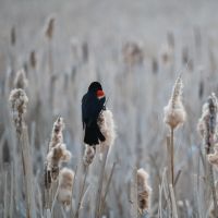
Red-winged Blackbird
Scientific Integrity
The ABMI is committed to the responsible analysis and interpretation of data. We hold ourselves to the highest ethical standards, including operational transparency, honesty, conscientiousness, and integrity. The ABMI strongly encourages the responsible and ethical evaluation and interpretation of the knowledge contained in this report. For a complete discussion of the ethical behaviour endorsed by the ABMI, please see Honor in Science, published by Sigma Xi. A broader discussion about the use of ABMI data and information can be found in the following report: Scope and Application of the ABMI’s Data and Information available here.
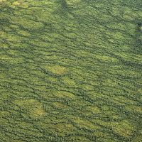
Patterned fen
Terms & Conditions of Report
The Alberta Ministry of Environment and Protected Areas (EPA) has provided funding to support this work; however, the report's content does not necessarily reflect the position of EPA
The ABMI initiated the development of this report to bring together wetland information in an online platform. This report was prepared by the ABMI, and ABMI maintains full control over all language and messaging in this report. This report is a living document. The online report format allows for easy updates of existing content as well as the addition of new sections and information as it becomes available. The first edition of the Atlas represents the current state of our knowledge, with future editions to reflect stakeholder feedback and new reporting indicators as they are developed. We envision this Atlas will bring wetland data together from various data providers.
This report relies on data from ABMI’s long term biodiversity monitoring programs, which are funded by the Government of Alberta. eDNA data was collected with support from the Nature Conservancy of Canada’s Conservation Science Impact Fund, with technical support on protocol development and DNA sequencing and analysis from InnoTech Alberta.
The following terms were applied as conditions of the ABMI preparing this report:
- The ABMI reports on a standardized list of biodiversity and land cover indicators that are relevant to regional planning, policy, and management. Developed by the ABMI, these indicators will be applied consistently.
- The ABMI maintains full control over all language and messaging in this report.
- This report encompasses various areas in the province of Alberta (e.g., natural regions); results cannot be localized to smaller landscapes within the area unless already specified in this report.
- This report was released publicly in 2023 using biodiversity data collected between 2003 and 2021, land use data collated from 1999 to 2019, and open-source satellite data collated and produced between 2017 and 2020. The wetland dataset is derived from freely available satellite data: Sentinel-1 Synthetic Aperture Radar (SAR) data, Sentinel-2 optical data, and Advanced Land Observing Satellite (ALOS) topographical models. Any updates to the results and overall report will be noted.
- Future versions of this report may include contributions from external collaborators; the terms and conditions would be updated to reflect this.
Preferred Citation
Alberta Biodiversity Monitoring Institute. 2023. Wetland Atlas of Alberta. Alberta Biodiversity Monitoring Institute, Alberta, Canada. Online report available at: https://www.abmi.ca/home/publications/601-650/630
We are grateful for the support of the ABMI's delivery partners.

We would like to acknowledge the organizations and sponsors highlighted below who financially supported the development of this report.