Butterfingers
Dactylina spp.
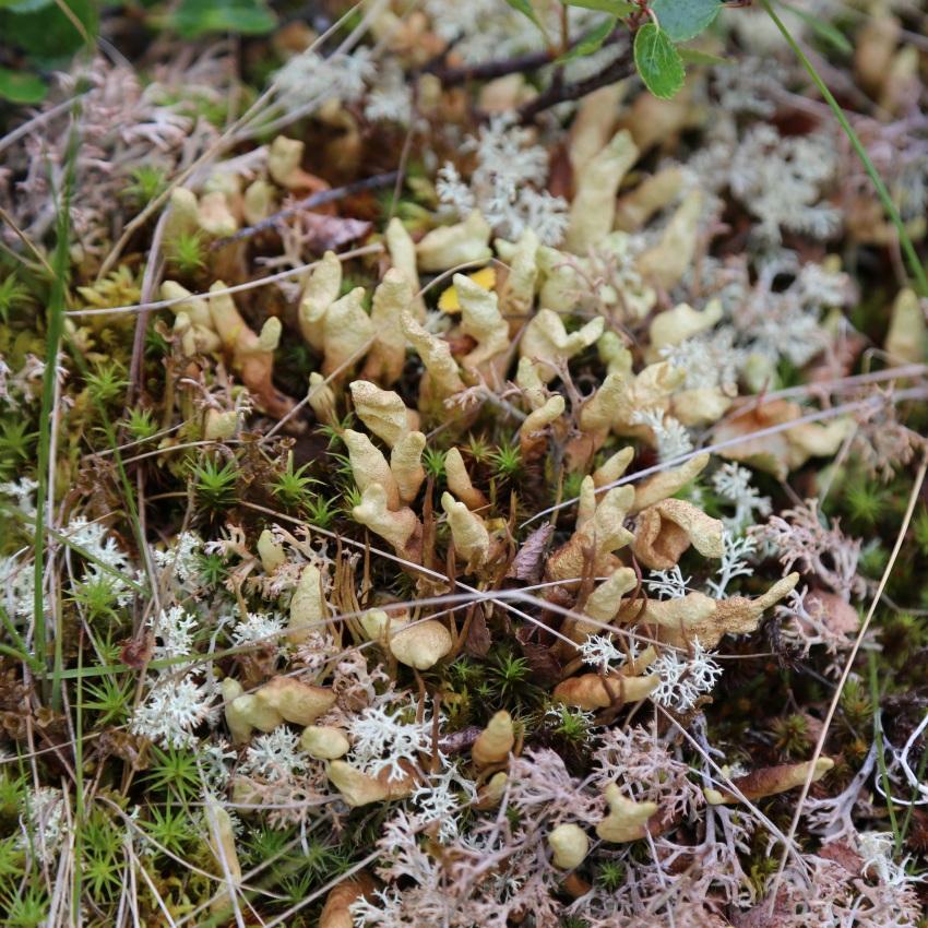
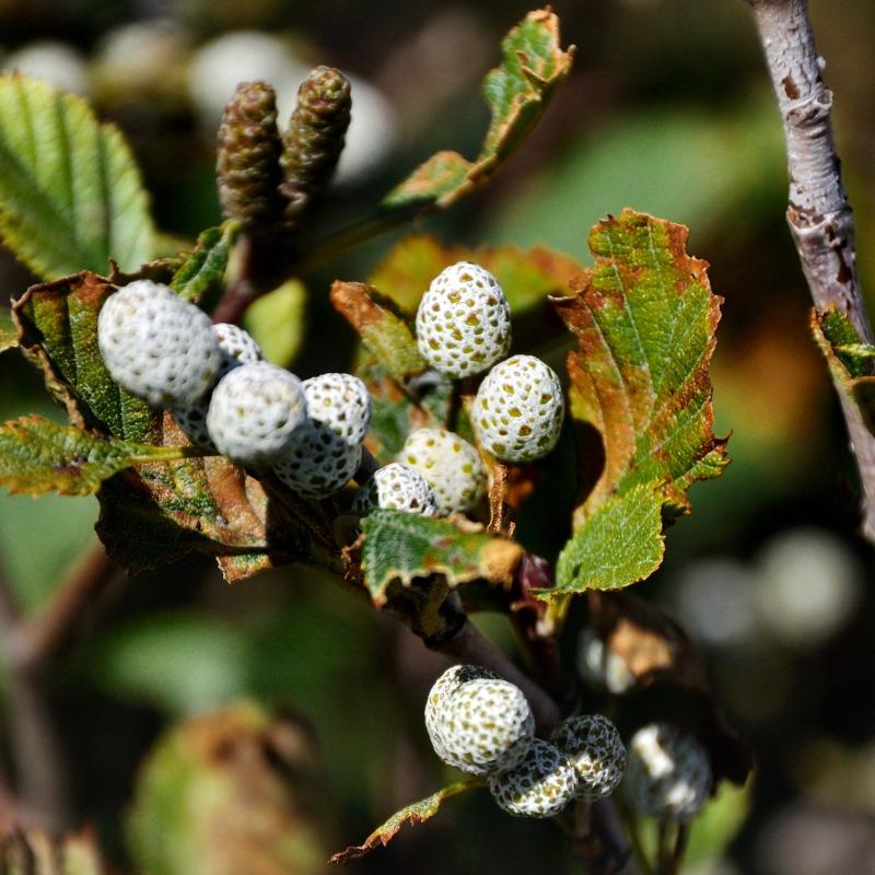
White Worm Lichen (Thamnolia subuliformis) and Butterfingers (Dactylina species—pictured) can be found on hummocky areas and edges of alpine graminoid meadows. Both are unique to montane areas in Alberta.
Section 2.4
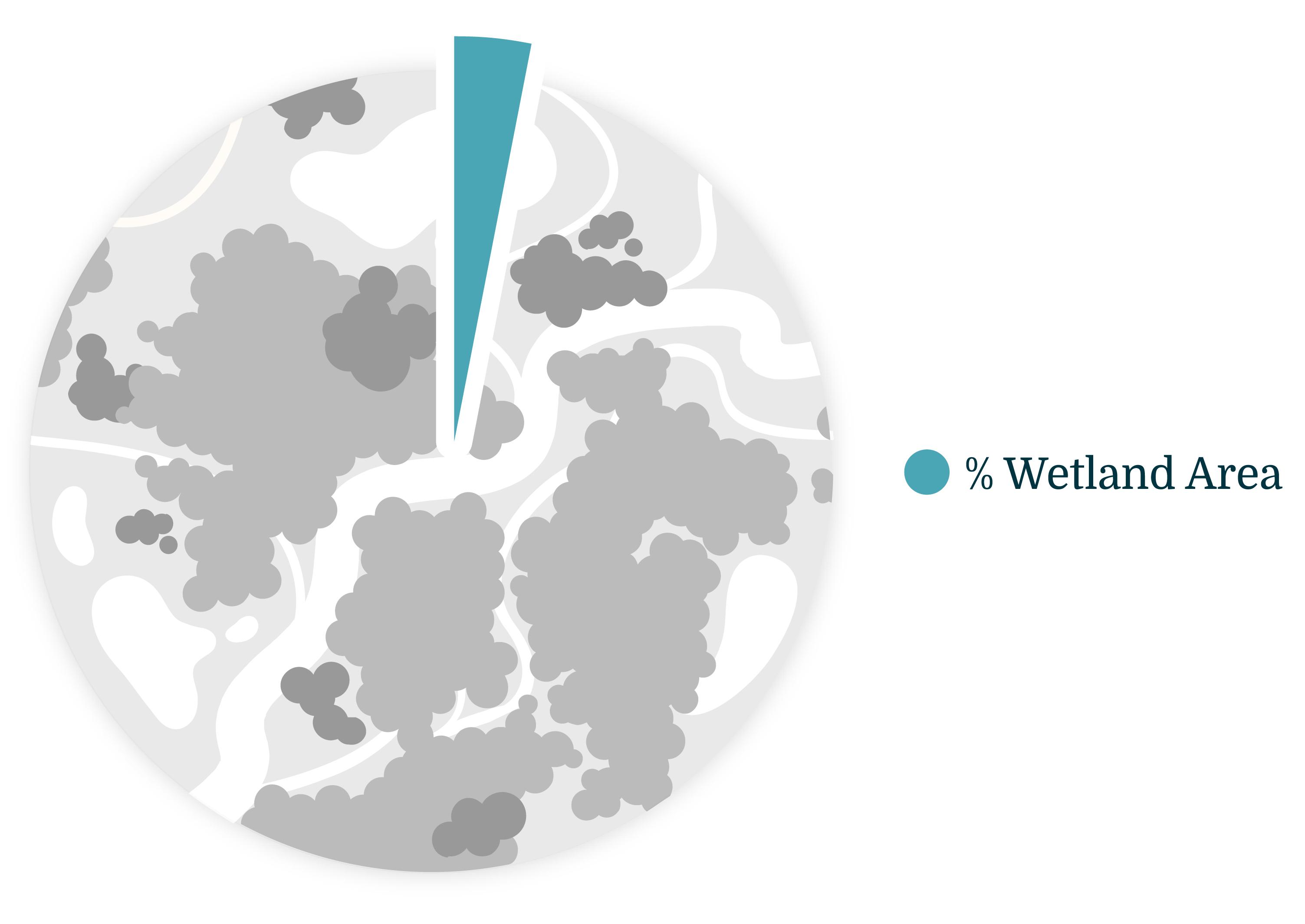
Summary of the area of wetlands in the mountain region by wetland class with a description of the most common classes.


Total area of wetlands in the mountain region: 3.2%
In this section, we summarize wetland class and percent area in the mountain region of Alberta. We also highlight key wetland characteristics and species associated with the most common wetland classes.
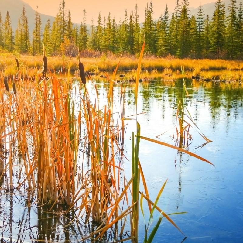
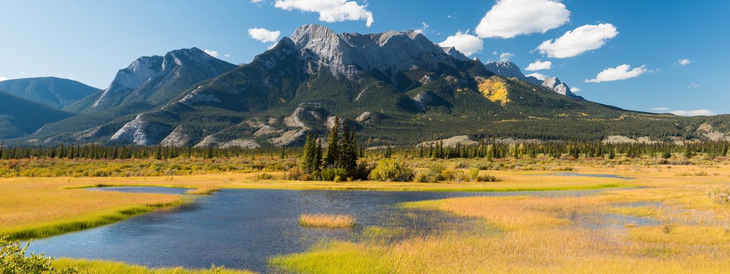
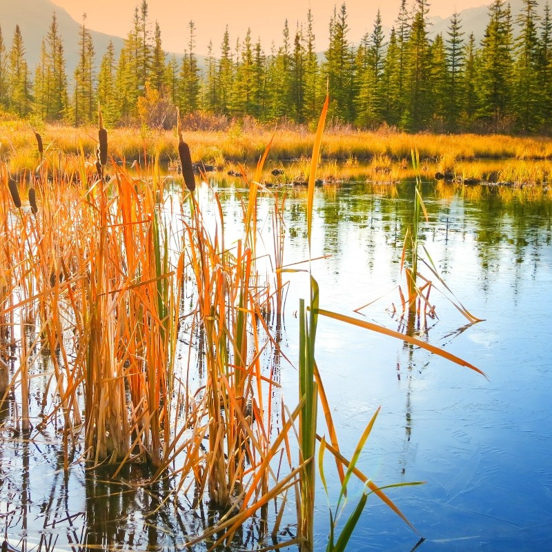
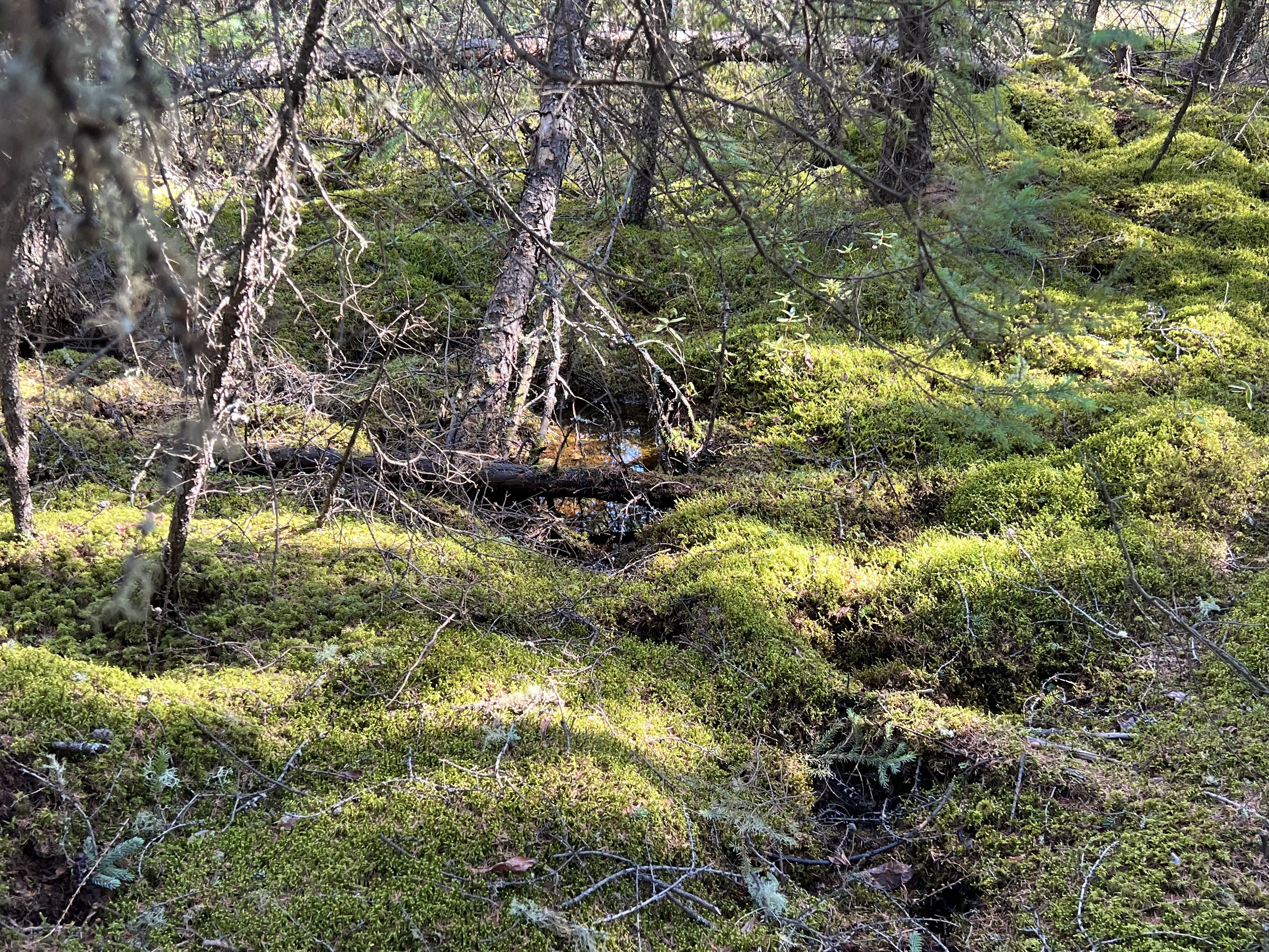
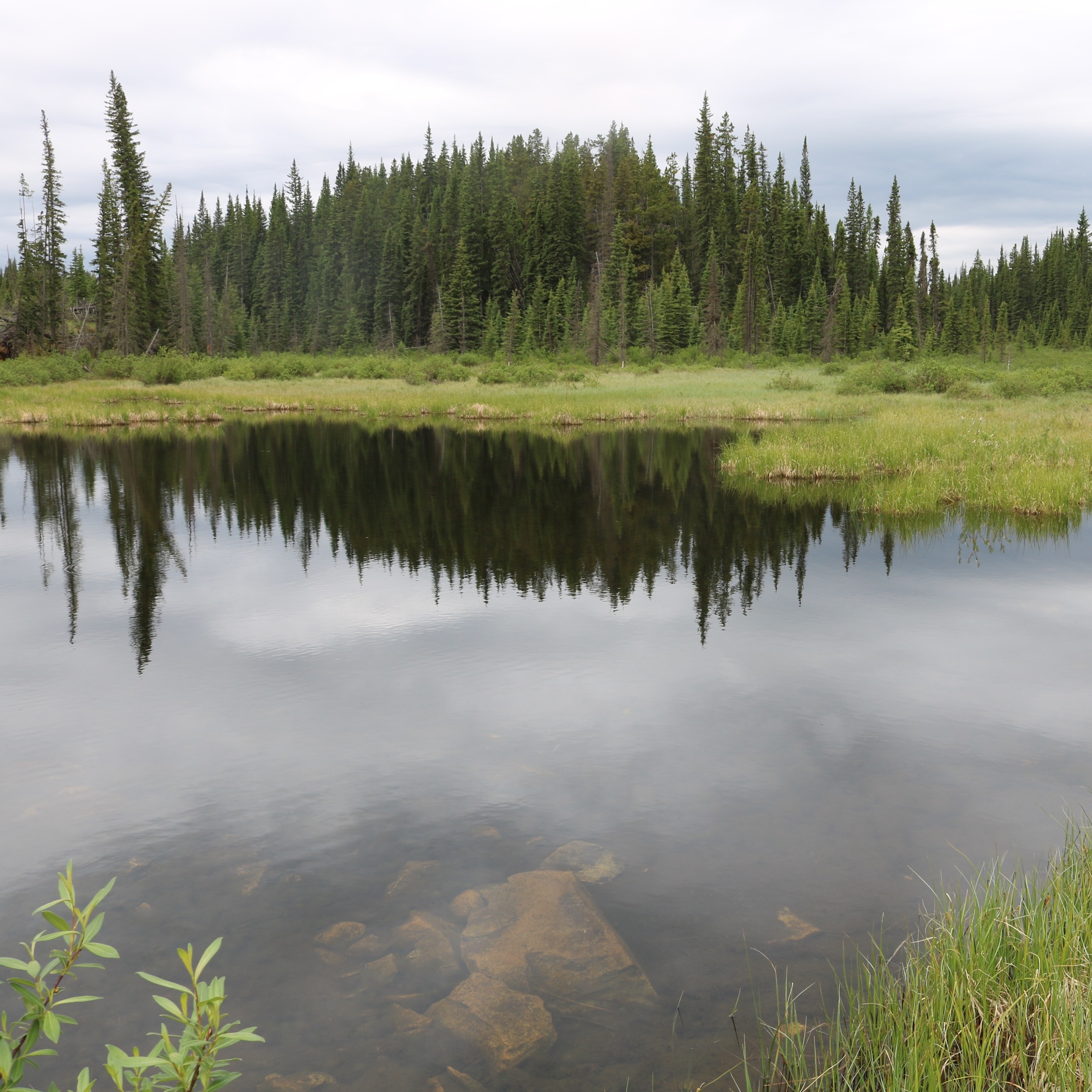
Wetlands in the mountain region are mostly located in valley bottoms.
Area of Wetlands in the Mountain Region
Total area of wetlands in the mountain region: 3.2%
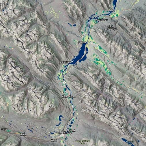
Distribution of wetlands in the mountain region of Alberta. Click on the legend to turn wetland types on and off. Note: wetlands cover less area than what is displayed in the map.
Click on a tab for a description of the most common wetlands in the mountain region. For more detailed descriptions of each wetland class, refer to the Alberta Wetland Classification System Field Guide[4].
-square.jpg)
 Diane Haughland
Dactylina spp.
White Worm Lichen (Thamnolia subuliformis) and Butterfingers (Dactylina species—pictured) can be found on hummocky areas and edges of alpine graminoid meadows. Both are unique to montane areas in Alberta.
 Diane Haughland
Hypogymnia spp.
Tube lichens (Hypogymnia tubulosa pictured) grow on branches and trunks of conifers and shrubs in moist mountain ecosystems.
 Ania
Ania
Alnus alnobetula
Green Alder is a clumping shrub that grows quickly on poorer soils with sufficient light. It requires moist soil.
 Andrew DuBois
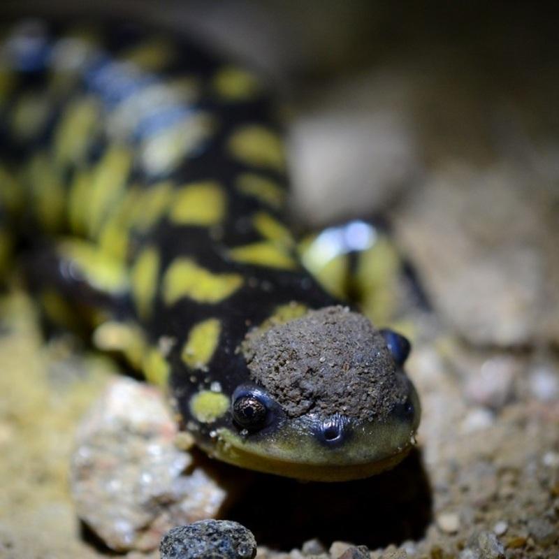
Ambystoma macrodactylum
The Long-toed Salamander is mainly found in the Rocky Mountains in Alberta, where it breeds in lakes or ponds that are free of fish.
 Rob Hinchliffe
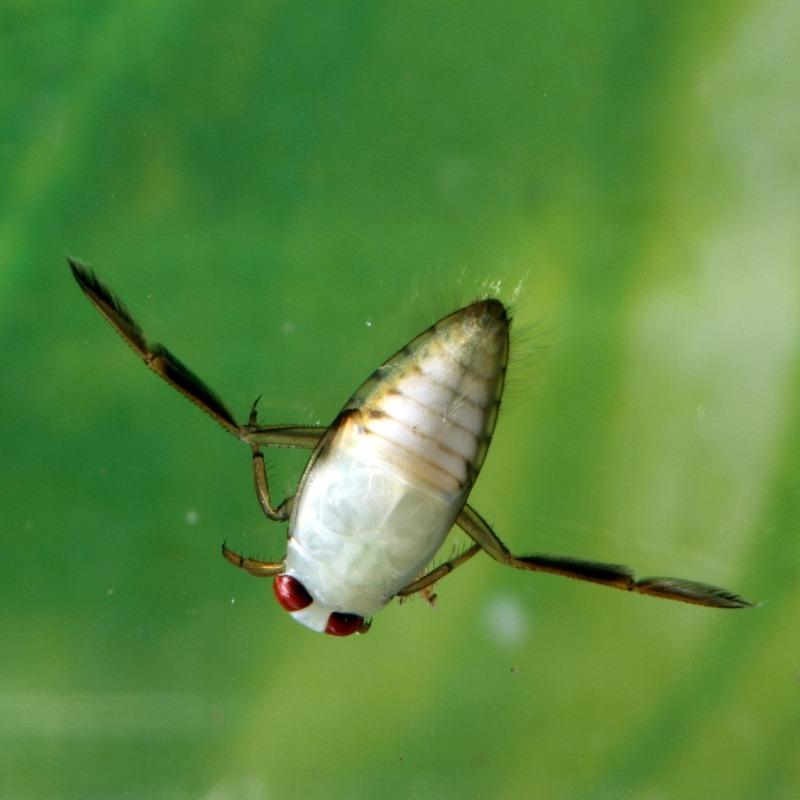
Notonecta undulata
Not exclusive to the mountain region, but common in many subalpine ponds, Backswimmers are one of the top predators in higher elevation wetlands.
 Rob Hinchliffe
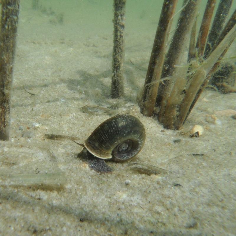
Planorbella subcrenata
Rams-horn Snails are common in mineral-rich wetlands of the mountain region. They have a high reproduction rate, laying multiple batches of eggs throughout the summer months.
 Rob Hinchliffe
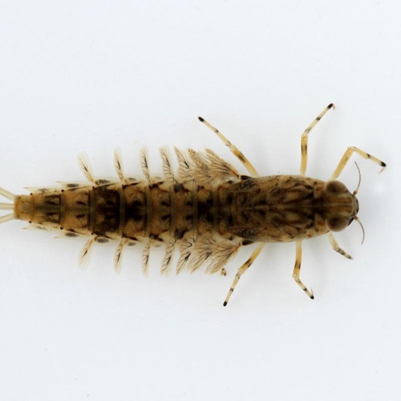
Siphlonurus spp.
Siphlonurus mayflies, often referred to as Gray Drakes by fly anglers, are most common in clean, cool wetlands and slower moving streams that support healthy weed growth.
Alberta Parks. 2015. Natural regions and subregions of Alberta: a framework for Alberta's parks. Available at: https://www.albertaparks.ca/media/6256258/natural-regions-subregions-of-alberta-a-framework-for-albertas-parks-booklet.pdf
Bayley, S.E. and J.K. Guimond. 2008. Effects of river connectivity on marsh vegetation community structure and species richness in montane floodplain wetlands in Jasper National Park, Alberta, Canada. Ecoscience 15(3):377-388. Available at: https://doi.org/10.2980/15-3-3084
Morrison, A., C. Westbrook, and A. Bedard-Haughn. 2014. Distribution of Canadian Rocky Mountain wetlands impacted by beaver. Wetlands 35:1:10.
Ducks Unlimited Canada. 2021. Alberta wetland classification system field guide. Available at: https://www.ducks.ca/resources/industry/alberta-wetland-classification-guide/
ABMI Geospatial Centre. 2021. ABMI wetland inventory: technical documentation. Report available at: https://abmi.ca/home/data-analytics/da-top/da-product-overview/Advanced-Landcover-Prediction-and-Habitat-Assessment--ALPHA--Products/ABMI-Wetland-Inventory.html
ABMI. 2017. 3 x 7-km sample-based human footprint data. Available at: https://abmi.ca/home/data-analytics/da-top/da-product-overview/Human-Footprint-Products/Human-Footprint-Sample-Based-Inventory.htm
ABMI. 2018. Wall-to-wall human footprint inventory. Available at: https://abmi.ca/home/data-analytics/da-top/da-product-overview/Human-Footprint-Products/HF-inventory.htm

Jennifer Hird, Lead Scientist—Earth Observation Insights Unit, Alberta Biodiversity Monitoring Institute (ABMI)
Jen has supported geospatial research and development within the ABMI for over 10 years. In her current role, she leads the organization's satellite-based mapping and monitoring efforts.
If you have questions about the ABMI's wetland mapping program, please get in touch: jennifer.hird@ualberta.ca